White Pond and Nine Acre Corner Area History
by Robert Gerzon
Introduction
I collected this history from various sources so that it would be available to residents and visitors to the White Pond area, and anyone who is interested in learning more about this beautiful and historic part of Concord.
Many generations have lived on this land before me and I hope many generations will enjoy it in the centuries to come.
With so much history and such a vast span of time, I have attempted to keep this history as brief as possible, while including important events and interesting stories. My apologies for any inaccuracies or omissions.
My primary sources for the following history are:
The First Peoples of the Northeast by Esther K. Braun and David P. Braun (Moccasin Hill Press, 1994)
From Musketaquid to Concord: The Native and European Experience by Shirley Blancke and Barbara Robinson (Concord Antiquarian Museum, 1985)
History and Legend of the White Pond and Nine Acre Corner Area, Concord, Mass. by Carolou Marquet (Concord Library, unpublished manuscript, 1973)
Special thanks to Shirley Blancke for her crucial role in creating more awareness of the Native American presence in Concord. She is the Associate Curator of Archaeology and Native American Studies at the Concord Museum and a longtime Concord resident. I highly recommend Shirley Blancke's book From Musketaquid to Concord to anyone interested in learning more about Concord's Native American history.
Special thanks to Carolou Marquet for permission to quote from her History and Legend of the White Pond and Nine Acre Corner Area. She lived in Concord on Paul Revere Road for 17 years and served on the White Pond Study Committee in the mid 1970's. Carolou Marquet's History remains an invaluable record of this aspect of Concord's past. It was originally created for the children at Willard School. The entire document is available here.
Geological History
Glaciers still covered this land 15,000 years ago. But gradually the thick ice sheets melted. As the glaciers receded, here and there big blocks of ice remained stuck in the ground.
When these melted they left behind bowl shaped depressions that we call kettle holes. Some of these kettle holes dried up but others were filled with water from underground streams and became kettle ponds.
Both Walden Pond and White Pond were created during this time. The landscape looked very different then. Ice Age mastodons roamed the open tundra and grasslands. As the climate warmed, spruce, pine and hemlock forests appeared, followed by oak and maple trees.
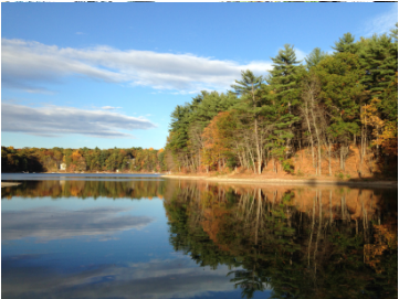
Today White Pond covers 43 acres and has a maximum depth of about 60 feet. It has no inlets or outlets and is fed by groundwater and runoff.
Native American History
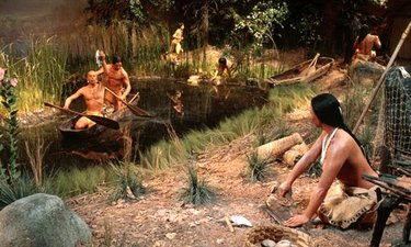
By 11,000 years ago the first Native Americans followed herds of caribou into the New England forests. In this pristine new land they hunted and fished, built shelters, and gradually developed a healthy and stable culture. By 1,000 BC they were making pottery and by 1,000 CE they were farming. The New England region was populated by a people who became known as the Algonquins. They occupied the coasts and inland river valleys, maintained alliances, intermarried and experienced a prosperous and mostly peaceful existence.
The Concord-Sudbury River and its meadowlands were known as Musketaquid which means "place of reedy grasses." In the years before the arrival of the Europeans, Native Americans enjoyed a seasonal round of varied activities. In the spring and autumn the Native people of Musketaquid would paddle down the Concord River and meet with other tribes at Pawtucket Falls on the Merrimack River in present-day Lowell. The seasonal runs of salmon, eel and alewife provided abundant food for everyone. This was a time for feasting, socializing, matchmaking, and trading.
The Concord-Sudbury River and its meadowlands were known as Musketaquid which means "place of reedy grasses." In the years before the arrival of the Europeans, Native Americans enjoyed a seasonal round of varied activities. In the spring and autumn the Native people of Musketaquid would paddle down the Concord River and meet with other tribes at Pawtucket Falls on the Merrimack River in present-day Lowell. The seasonal runs of salmon, eel and alewife provided abundant food for everyone. This was a time for feasting, socializing, matchmaking, and trading.
 Willard School Emblem
Summer was the time for planting the "Three Sisters," corn, beans and squash. Willard School on Powder Mill Road is located upon ancient Native American agricultural fields.
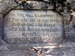 Egg Rock
Nashawtuc Hill was a popular spot, as was Egg Rock where the Sudbury and Assabet Rivers flow together and become the Concord River. The Native people paddled dugout canoes along the rivers, looking for turtles and other delicacies. Clams were plentiful at the river bluffs near present-day Emerson Hospital.
White Pond and the Nine Acre Corner area offered swimming, fishing and rich farmland. Many arrowheads and stone tools have been found in area around White Pond. Indian campsites have been documented in the Plainfield-Anson Road area. Indian artifacts have also been found near Sachem's Cove. The landscape offered an abundance of wild foods such as mushrooms, berries, grapes, nuts and edible roots. Teas were brewed from sarsaparilla, birch and mint.
Fall and winter were hunting seasons. Bows were made from aspen and hickory. Arrows were crafted from elder, fletched with feathers and equipped with sharp stone arrowheads. The cold, snowy winter was a time for staying inside the bark-covered lodges with grandparents telling stories around the fire. In this way the ancient wisdom passed from one generation to the next.
1600's
The arrival of the Europeans changed everything. Lethal epidemics introduced by early traders and explorers decimated the Native population. By the time the Pilgrims arrived at Plymouth in 1620, the Native culture had undergone a devastating crisis. Successive waves of settlers brought new rounds of epidemics.
When Peter Bulkeley and Simon Willard came to found the new town of Concord in 1635, the population of Musketaquid was a fraction of its previous size.
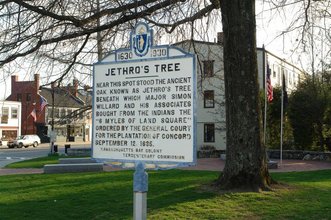
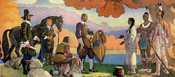
A ceremony was held at Jethro's Tree near what is now Monument Square, located in Concord Center. The remaining Native people welcomed the newcomers to share their land. A deed was signed granting six square miles to the Englishmen. In return the Natives received gifts of wampum, hatchets, tools and clothes.
Tahattawan, one of the signers, lived with his family at Nashawtuc Hill. Another signer, known only by her title of Squaw Sachem, was a female chief who lived in Mystic River area now occupied by the Towns of Arlington and Winchester.
A similar scene is depicted below in an artist's vision of Squaw Sachem granting the use of her Winchester land to John Winthrop, Governor of Massachusetts Bay.
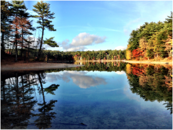
The beautiful cove at the western end of White Pond is called Squaw Sachem Cove in her honor.
[Note: Some people today find the term squaw to be offensive, but many Native people recognize it as a traditional Algonquin word for woman with no pejorative meaning. See Wikipedia entry for squaw for more information.]
Peter Bulkeley, one of Concord's founders, owned a nine acre meadow in the southwest part of Concord (known then as the South Quarter). The path to his meadow was known as the Way to the Nine Acres. The area around it became known as Nine Acre Corner. This refers to the area around the intersection of present-day Sudbury Rd, Powder Mill Road and Seven Star Lane. This fertile land is still farmed in an area called Willow Guzzle Reservation. Currently "Nine Acre" is often used to refer to the intersection of Sudbury Road and Route 117 because several stores there have Nine Acre in their name.
By 1675 after wave after wave of immigrants had pushed Native people onto smaller and smaller parcels of land, many Native people in New England realized that they were in danger of losing their land forever. Metacom, also known as King Philip by the English, was a Wampanoag chief. He rallied the remaining tribes and attempted to push the English back from areas like Marlborough, Concord, Sudbury into Boston. From the perspective of the English settlers, these were "frontier towns" that bordered hostile "Indian country" and the "wild west."
What became known as King Philip's War had a major impact on this area. Decisive battles were fought just south of White Pond in Sudbury (at King Philip Woods and Wadsworth Cemetery in Sudbury). Concord was spared a direct attack. The Native forces retreated and English settlement continued westward.
1700's
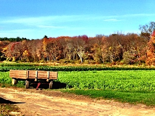
During the 1700's farming in the Nine Acre Corner area became well-established. Several farmers lived in the area. The Wheeler family was one of the most well-known farming families in Concord.
William Parkman operated a farm and tavern located at the corner of what is now Sudbury Road and Powder Mill Road from 1770 to 1795. He bought the land from Francis Wheeler. Although the road at that time was little more than a dirt path, it was still a major route. Wagons, pulled by as many as a dozen horses, would stop at Parkman's Tavern. The horses were housed in the barn across Powder Mill Road.
On April 19, 1775, Parkman was one of the messengers sent to Sudbury to warn of the approach of the British. After 1795 he sold the farm, opened a country store in Concord center, and ran the post office from 1795-1810.
The Fitchburg Turnpike (Route 117) was a well-traveled route. The Whipple Tavern was located near Lee's Bridge and present-day Brigham's Farm.
A mystery about White Pond and a pirate's treasure chest is retold by Carolou Marquet. The following excepted from her History:
Edward Rowe Snow tells the details in his book True Tales and Curious Legends. Thomas Tew, a famous pirate in Captain Kidd's day, and his pirates captured a Moorish vessel off the coast of Africa, robbed it of its treasure, killed almost everybody, and scuttled the vessel. He rescued only a beautiful Moorish lady and brought her on board his ship. His booty consisted of three treasure chests filled with gold, diamonds, and other precious jewels, valued in today's market at about a quarter of a million dollars.
Tew sailed back to New England and was hit by a violent storm off the New Hampshire coast. His pirates got drunk and one by one were washed overboard. When his ship was finally wrecked on Boon Island, Maine, only he, his first mate Juan Carlos, and the Moorish lady were alive.
The survivors collected all the booty they could from the wreck and hid it in a chest on the island. Soon after, the Moorish lady killed Captain Tew and then committed suicide, leaving only Juan Carlos alive on the island. Juan Carlos was finally rescued and after three years was able to go back to Boon Island to collect his treasure. He put the treasure in deerskin pouches and a week later went to White Pond in Concord where he had friends. There they buried it on the shore.
Digging for the treasure went on for many years. Thoreau, many years later, tells of seeing holes at the beach made by treasure seekers. The fate of the treasure is unknown. Many are sure that those who dug up the treasure rowed out to the middle of the pond and dropped the sacks into 60 feet of water to what may still be their final resting place!
1800's
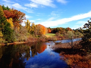
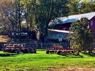
Farming was a thriving enterprise in the 1800's in the land surrounding White Pond and Nine Acre Corner. The flat fertile plains around the Sudbury River were once the bottom of a vast glacial lake. When the lake dried up, Native Americans farmed the land and fished in the river. The English settlers recognized the agricultural value of this land and it has been farmed continuously since Colonial times.
Heath's Bridge was built in 1802 connecting Concord Center with Nine Acre Corner directly via Sudbury Road. Before this time people used the longer route via Old Road to Nine Acre Corner.
The following is excerpted from Carolou Marquet's History:
Heath's Bridge was built in 1802 connecting Concord Center with Nine Acre Corner directly via Sudbury Road. Before this time people used the longer route via Old Road to Nine Acre Corner.
The following is excerpted from Carolou Marquet's History:
|
Over the years the main crops raised on local farms were cucumbers, tomatoes, rhubarb, corn, potatoes, and turnips.
Most farmers had an apple orchard. By careful searching through our local woods these old orchards, or what remains of them, can still be found. One of them was right out in front of Willard School... Willard School is built where there was once an asparagus farm... Many early farmers also raised grapes. The remains of these vineyards are found growing wild all over Concord... Most farmers in this area also raised cows and sold dairy products, the same as today. But in those days before refrigeration, each farmer built himself an ice house on the side of a hill where he could store his dairy products and keep them cool. He did this by harvesting blocks of ice from shallow ponds in the middle of the winter, then storing them in the ice house where it would last through the summer. Snowstorms added to the work and someone falling in added to the excitement. An old ice house can still be found beside the Verrill barn on Plainfield Road… Slavery was abolished in Massachusetts in 1780. Black men and women had lived in Concord prior to this time and quite a few runaway slaves sought refuge in Concord and other northern communities. One such was Thomas Dugan, born around 1747, who escaped from slavery in Virginia and came to Concord in 1787… Thomas raised rye and was the first person in Massachusetts to own a rye cradle, a large tool, similar to a scythe. He was also admired for his expert ability in grafting apple trees. His wife Jennie was an honest, energetic woman...They lived in the southwest part of Concord, not far from Nut Meadow and Nine Acre Corner. Thoreau visited Jennie's springhouse at the invitation of Jennie's sons and found it a "delectable place." Butter and milk, cool and sweet, were there, "but there was a leopard frog swimming in the milk and another sitting on the edge of the pan." Jennie probably outlived Thomas and thus the springhouse, brook, and eventually the street were named for her. Another area frequented by Thoreau on his many walks was a pine-clad hill on the southwest side of Fairhaven Bay which was part of a large farm owned by Eben Conant. In 1845 when Thoreau and Channing started rambling around the countryside, they thought that every pretty spot should have a distinctive name. Jackson's "History of Newton" had just come out. It told that the old Indian name of Newton was Nonantum, so when Channing and Thoreau were talking over a good name and wondering if the Indians had a special name for the area, they thought that they themselves would make one that would be just as good as Nonantum. They called the area Conantum. The fact that awareness of the fragile beauty of the countryside is not an invention of the 20th century is reflected in Emerson's Journal when he says, "On the steep park of Conantum I have an old regret—is all this beauty to perish?" … At one time there was a Nine Acre Community Club where everyone would get together; but according to Mrs. Anderson the most fun was having a beach and swimming party at White Pond. The Irish men and girls who worked on nearby farms would congregate near a large stone at the entrance of Wheeler Road. This stone was called the Blarney Stone. In the latter 1800's "the Corner" gained a statewide reputation for market gardening and as a greenhouse region. Anson Wheeler, born in 1863, was a scientific farmer, known all over New England for his excellent produce and sound agriculture. He was the first in Middlesex County to successfully grow cucumbers under glass, his maximum yield being 64 bushels a week! He also grew rhubarb, lettuce, radishes, and beets under glass. He lived in the old house on the west side of Plainfield Road at the intersection with Wheeler Road.The house was built in 1803 by his grandfather, Cyrus. Alva Wheeler, brother of Anson, built his home at the corner of Wheeler Road and Plainfield Road around the mid-1850's. This house is presently owned by the Verrill family. Wheeler Road is named after Alva. Anson's sons were Raymond and Alden. All three have streets near their homestead named for them. |
Around 1840 some powder mills were established beyond the southwest corner of Concord in Acton. They manufactured gun powder and explosive accidents were common. A road leading from the Nine Acre Corner area to that section of Concord and Acton became known as Powder Mill Road, the name by which it is still known.
In the 1870's the Framingham and Lowell Railroad, later known the New York, New Haven, and Hartford, was constructed close to the western edge of White Pond. Trains continued to run until the 1970's. The old railroad bed is scheduled to be transformed into the Bruce Freeman Rail Trail in the next few years.
1900's
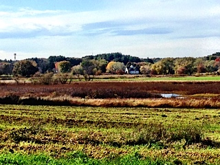
Farming continued in the 1900's, although by mid-century the growth of Concord resulted in the conversion of much farmland into residential areas. Fortunately a great deal of land has been preserved as farmland. Verrill Farm maintained a seasonal outdoor farm stand for many years. In 1995 they built their first indoor farm stand. After a fire destroyed the building the Verrills constructed a new, larger eco-friendly facility in 2009 that is a popular destination for people seeking locally-grown vegetables and prepared foods from their own kitchen/bakery.
Willard School was constructed in 1958, and an addition completed in 1966. The new eco-friendly Willard School replaced the previous building in 2009.
Until mid-century there were only a few houses in the area. The present-day residential areas along Powder Mill and Plainfield were still rural farmland.
In the 1930's, the increased use of automobiles brought more out-of-town swimmers to the White Pond beach near Plainfield Road. Chartered buses brought even more people to the pond on hot days. Rowdy parties and alcohol use resulted in public disturbances.
Carolou Marquet writes that, "In 1930 the White Pond Association was formed as a non-profit organization for the purpose of saving the beach for local people."
According to Amy and Floyd Verrill (Concord Oral History Program):
"Douglas Miller was living on the corner of Powder Mill Road and had been distressed with the growing number of out-of-town cars that went to White Pond evenings. There was no supervision and it was noisy. When he learned of the proposed sale he acted as a far-sighted and public-spirited citizen and quickly got a group together to form the White Pond Associates and purchase the beach area."
Today the White Pond Association operates a swimming beach with lifeguards from the beginning of June through Labor Day. Membership is open to all Concord residents. Current membership is approximately 700 families.
A major development in White Pond's history occurred in 1931 when a real estate developer named Thomas F. Reilly purchased much of the farmland to the north and south of the pond. His development was called Pine Knoll Shores and consisted of small lots that he sold for around $73 as sites for summer cottages. Lots sizes were 1750-2500 sq. ft. and streets were narrow.
Each cottage had its own well and septic system. The small lots and narrow streets in this private development created many future problems as these vacation cottages were replaced by permanent homes, without the benefit of Town services such as water, sewage, road maintenance, or snow plowing. Some of these problems have been rectified while some remain. The Pine Knoll Shoes development created streets that function as public ways but are legally classified as private roads. They are not maintained by the Town and there exists no established entity to supervise or fund the maintenance of these roads.
In 1966 the Dover Property Owners Association (DPOA) was established to address the needs of the neighborhood and the maintenance of the neighborhood beach.
In the 1960's and 1970's a renewed environmental awareness led to the formation of White Pond study groups to identify threats to the health of the pond, promote the preservation of the pond and surrounding landscape, and address the special issues of the White Pond neighborhoods. This resulted in the creation of the White Pond Advisory Committee, a five-member committee appointed by the Selectmen to address the concerns of the White Pond neighborhood in 1975. The Friends of White Pond was established in 1987 by concerned residents to preserve and improve the quality of the pond.
In the 1970's, an influx of out-of-town swimmers to the Sachem's cove area at the western end of the pond resulted in problems in the neighborhoods immediately surrounding White Pond. Rowdy parties, alcohol, altercations, trash, traffic, parking on people's lawns resulted in frequent calls to the police. (See Ponderings newsletters, 1994-95).
According to former Concord Police Chief Len Wetherbee, “Right in the late 70s, on any given night…there could be 100 cars parked around the pond." A concerted neighborhood effort, resulted in parking-by-permit-only regulations by the late 1970's. This resolved the problems in the neighborhood.
In the 1980's an algae bloom indicated water quality issues.
Large wooden signs were posted in 1989 on Town land at the cove by the Division of Natural Resources prohibiting swimming, alcohol and fires.
By the 1990's and 2000's the Internet and GPS resulted in more people discovering the free swimming available at the cove. Traffic in the Dover Street area again became a problem and people began parking in the neighborhoods just beyond the regulated permit-parking streets.
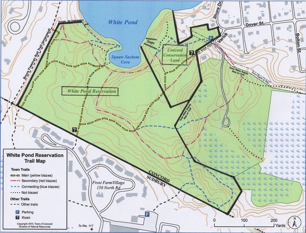
In 1992 the Town of Concord, concerned about protecting the land and the water quality of White Pond and the nearby Town well, bought 40 acres from UniSys which is now the White Pond Reservation land. The overriding objectives of the acquisition were to protect Town water resources and to provide townspeople with an exceptional natural resource for passive recreation and education. By controlling the property, Concord could then protect it from inappropriate and excessive uses that had been tolerated by neglect (swimming, fires, drinking, off‑road vehicles) or had been proposed (high‑density housing, golf course).
The acquisition could not have been accomplished without the extraordinary efforts of the Trust for Public Lands and its director, Peter Forbes. TPL played a critical role by investing its own funds in the transaction and by working closely with the seller (the UNISYS Corporation) and the Town of Sudbury to settle difficult issues between them, thereby allowing Sudbury to acquire a significant tract of open land and wetlands that form part of Sudbury's scenic corridor along Route 117.
The purchase price for Concord's 40‑acre acquisition was $323,435, or roughly $8,000 per acre. The source of funds was $300,000 from the Land Fund and $23,435, which the Friends of White Pond raised from over 50 private individuals and groups.
In 1992 a White Pond Management Plan was prepared by the White Pond Task Force stressing the need for the Town to actively manage and preserve the conversation and reservation lands at Sachem's Cove. Restoration projects helped improve the Sachem's Cove area but the Town did not maintain it afterward. Continued overuse and misuse led to further erosion.
2000's
In 2000 a giardia outbreak in White Pond was attributed to swimming by the State Board of Health. Sanitation was improved at the White Pond Associates Beach but unsupervised swimming with no sanitation facilities continued at the Town-owned land on the Cove.
In 2002 a White Pond Reservation and Conservation Land Management Plan was submitted to the town by the White Pond Reservation Task Force. This document has valuable insights and details more of the Pond's history. It recommended that the Town "Transfer the White Pond Reservation to Natural Resources Commission as conservation land." To date no action has been taken by the Town to do so.
"Reservation Land" is reserved by the Town Selectmen for possible future development. "Conservation Land" is protected by the Division of Natural Resources from development and preserved in its natural state for future generations.
Of the Town-owned White Pond lands, 40 acres are Reservation and only 10 are Conservation. Past development proposals for the White Pond Reservation have included a wastewater treatment plant and an array of solar panels. Any development of this type would forever alter the character of this natural landscape.
Currently White Pond Reservation is not protected against future development and it is not being actively managed and regulated. As a result it is becoming degraded through misuse.
Anticipating the influx of people to the pond from the completion of the Bruce Freeman Rail Trail, the White Pond Advisory Committee issued a White Pond People Management Plan in 2006. In 2006 the Division of Natural Resources funded rangers to patrol the conservation-reservation land but were discontinued due to lack of funds.
According to the White Pond Advisory Committee’s 2008 White Pond People Management Plan and BFRT Impact, trespassing and illegal swimming threaten the health of the White Pond area in terms of water quality, erosion of the shoreline, litter and vandalism, noise and other disruptions of private property. They also recommended installing more "No Parking" signs on Powder Mill Road and extending permit-only parking to Alden and Anson Roads.
In 2014 residents of Alden and Anson Roads petitioned the Selectmen for relief from the problems caused by the increasing number of out-of-town swimmers parking on their streets. The Selectmen did not approve their request for parking-by-permit-only in their neighborhood. The Selectmen stated that the parking problems would simply be pushed into other streets and that the problems required a more comprehensive solution. The Town commissioned a parking consultant to study the parking issue. A White Pond Forum was scheduled for October and later rescheduled to January 2015.
In October 2014 the ESS Group presented a White Pond Watershed Management Plan, commissioned by the Division of Natural Resources and supported by Concord Community Preservation Act funding. Among other recommendations, this report highlights the need for the Town to clarify its position on swimming from Town land. Posted signs prohibit swimming but the Town does not enforce it, resulting in large numbers of unregulated swimmers on hot summer days contributing to erosion, littering and sanitation issues for both the pond and the conservation land. The ESS Plan concluded that "Taking no action to manage White Pond and its watershed could result in eventual degradation of water quality, particularly if public recreational pressure on the pond significantly increases…Therefore, the no-action alternative is not recommended."
The development of comprehensive White Pond Management Plan that includes the permanent conversion of White Pond Reservation to Conservation Land is the key to solving the current problems and protecting White Pond for future generations. This was recommended by the White Pond Advisory Committee in its 2002 White Pond Reservation and Conservation Land Management Plan (p. 11-12), by Concord's Open Space and Recreation Plan of 2004 (p. 37, 68), and again in the 2014 Open Space Plan, (p. 24). This Plan describes the White Pond area's "fragile aquatic ecosystem" as an "important watershed protection" for the Town well, an "important wildlife habitat" and "wildlife corridor."
In January 2015, a Town-sponsored White Pond Forum was attended by over 125 concerned citizens. Many people at the Forum voiced the need for a long-term management plan to preserve this valuable land.
In April 2015, the White Pond Advisory Committee released a new report on White Pond, A Shared Future: A Comprehensive Vision for White Pond, It's Watershed and Its Neighborhoods. The Committee recommended that the Town prohibit swimming from its land and restrict parking around the White Pond area.
At their May 4, 2015 meeting the Concord Select Board considered the possibility of turning the Town-owned land at White Pond into a swimming beach. They decided that putting the focus on preservation made more sense. They voted for a restoration project of the fragile shoreline and trail system. The Board members pledged to use 2015 to develop a long-term management plan in consultation with the White Pond Advisory Committee, White Pond Associates, neighborhood residents and the Town of Sudbury.
The Town funded a restoration plan, closed some trails, hired rangers, required dogs to be leashed, and prohibited swimming from Town-owned land during the 2015-2016 project. This restoration project was a positive step toward the long-term preservation of the pond and represents the efforts of many people today and over the past decades. However, during July-August 2015 the Pond suffered an outbreak of toxic algae (a dangerous sign of pond degradation and eutrophication). For the first time in its history, White Pond became unsafe for swimming and other forms of recreation and the White Pond Associates beach was closed by the Board of Health.
In 2018 the White Pond Associates Board of Directors donated more than 18 acres of beachfront property and surrounding fields to the Town of Concord. In 2019 the Town opened a new beach facility. Memberships are open to both residents and non-residents. In 2020 volunteers continue to monitor the pond water quality and advocate for its protection from overuse and misuse
A town-neighborhood partnership is crucial to preserving what Thoreau called "the most beautiful, of all our lakes, the gem of the woods." We recommend the establishment of a comprehensive, sustainable Management Plan that will preserve this historic natural area for future generations.
